United States Department of Agriculture
AgResearch Magazine


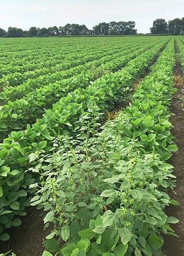
Weed Spotting By Drone
-
 ARS agricultural engineer Yanbo Huang (left) and technician Ryan Poe use a drone to identify glyphosate-resistant weeds in a Mississippi soybean field. (Daniel Fisher, D3873-1)
When ARS agricultural engineer Yanbo Huang hears a drone in a field, he is not hearing the droning of bees pollinating plants nor the thrum of a tractor or combine. Huang and his technician Ryan Poe are just out flying their DJI Phantom drones.
They are flying the drones—formally known as unmanned aerial vehicles (UAV)—30 to 60 feet above a soybean field near their lab in the ARS Crop Production Systems Research Unit in Stoneville, Mississippi, to hunt for glyphosate-resistant (GR) weeds.
Huang can already correctly identify a weed as GR or not GR about 90 percent of the time from lab and field studies. Glyphosate is the active ingredient in Roundup, and it is the country’s most widely used herbicide. But signs of glyphosate resistance have shown up in 10 different weeds across Mississippi. Several of the weeds have become major concerns to farmers, such as GR palmer amaranth (pigweed) in soybeans and GR Italian ryegrass in cotton.
“These two are perhaps the biggest problems right now,” says Huang. “Growers need to know which weeds in a field are glyphosate resistant and which are not, so they can apply the least expensive and least toxic herbicide and avoid spraying all of the weeds with more than one herbicide.”
Huang says the choices are to have someone walk through the field and collect samples from each weed, which is costly and inefficient, or gather data by remote sensing through satellite-, airplane-, ground-based, or drone-mounted sensors.
The best answer is a drone, especially if you want precision and a reasonable price.
Satellites tend to generate data and images that are too low in resolution to be useful for precision weed management, especially for the 5- to 10-acre fields common in the Mississippi Delta region. In addition, clouds can obstruct the view of a particular field just as the satellite passes over. Data from aircraft, which typically fly at altitudes of 1,000 feet or higher, cannot distinguish between crops and weeds, let alone GR and non-GR weeds. Ground-based sensors can provide the needed level of resolution, but they have to be moved from place to place within a field. That takes time and can be limited by the field conditions, according to Huang.
Travelling between too high and too close, drones fly under the clouds and in almost any weather.
“Last year, we could only fly our drone and capture data on dry, sunny, windless days. This year, we have a bigger drone and a better camera, and we have been able to fly even on really wet or windy days,” said Huang.
|
|
The new cameras Huang added this year record both narrow-band multispectral and hyperspectral imagery, which has increased accuracy regardless of the conditions.
Multispectral imagery is produced by sensors that measure reflected energy. In this case, the energy is reflected from each plant within four bands of the electromagnetic spectrum (gamma rays through visible light to radio waves). The four bands are visible green, visible red, red edge, and near infrared.
Hyperspectral imagery, in contrast, consists of data measured in as many as 150 narrower bands, each only 5 nanometers wide.
Together, they provide an incredible capacity to see that which cannot be seen by the human eye.
The types of sensors drones can carry continue to expand, and their flight capabilities continue to grow. They can even be programmed to fly following a GPS map of crop rows or field borders.
Once the data from a drone run is downloaded and analyzed by the algorithms Huang has developed, a GR weed registers as having a slightly different leaf pigment than a non-GR weed on an image of the soybean field.
One downside to using drone technology is the 2016 Federal Aviation Administration (FAA) regulation that requires drones to remain within the unaided sight of an operator or visual observer. That limits the size of the fields drones could be used to monitor.
Right now, Huang is still developing his drone-based system as a research tool to better understand the evolution of GR weeds.
“We will eventually develop a tool from this that could be used for farms,” Huang says.
When that time comes, Huang envisions that the data-gathering drone or a map of its results could be paired with a drone carrying herbicides. The herbicide-carrying drone might be automatically directed to deliver its chemicals with pinpoint accuracy. Glyphosate would only be applied to the susceptible weeds, a different herbicide would be applied only to the GR weeds, and no herbicide at all would be applied to nonweed plants.
“Precision herbicide application would benefit the farmer and the environment,” Huang points out.
In 2015, the FAA approved the first drone specifically designed to carry tanks of fertilizers and pesticides for spraying crops. Yamaha’s RMAX model, with a maximum payload of 218 pounds, is one of the largest civilian drones approved by FAA.
When the Association for Unmanned Vehicle Systems International (AUVSI) commissioned an economic impact report in 2014, a few years before the FAA finalized its first set of formal regulations for drones in 2016, it forecasted that agriculture would be the largest single sector to make use of drones. The industry is still changing based on these regulations.
“There’s strong data that indicates agriculture remains one of the most popular commercial uses for UAVs,” says AUVSI president and CEO Brian Wynne.
This view was seconded in a 2015 Bank of America Merrill Lynch global research report that projected agriculture will make up almost 80 percent of the commercial drone market in the future, with the potential to generate $82 billion worth of economic activity in the United States between 2015 and 2025.—By J. Kim Kaplan, ARS Office of Communications.
Key Facts
- Glyphosate is the country’s most widely used herbicide.
- More types of weeds are becoming resistant to glyphosate.
- ARS is using drones to pick out glyphosate-resistant weeds in a field.
- Drones have potential to generate $82 billion in economic activity over 10 years.
Full Story