Using Location Information To Improve Literature Searches
|
|
Agricultural Research Service ecologist Jason Karl is creating new options for helping researchers to conduct literature searches that go beyond using traditional search terms such as keywords or authors. With the help of a diverse team of collaborators, he has developed a search engine called “JournalMap” that uses research locations and physical site variables to identify scientific papers of interest.
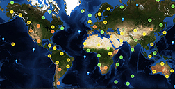
Articles in the JournalMap citation index are “geotagged” based on locations reported in the study and then plotted on a world map. This means that scientists can use JournalMap to search for environmental literature thematically and geographically just by selecting a location on a map.
This new approach to combing through scientific literature can help researchers find published research and data for their investigations in similar ecosystems where such information may be lacking. In some cases, simply identifying the locations of previous research can provide enough information to obtain pertinent ecological data from online geospatial databases.
The environmental factors tagged in JournalMap include climate variables such as daily temperatures during the growing season, average annual precipitation, and aridity index; landform characteristics, such as elevation and slope; soil characteristics, such as surface texture and depth; and types of land cover.
Karl and his collaborators are also working with Taylor & Francis, a publisher of more than 1,600 journals, to build literature geotagging into the publication process and to enable geographic literature searching of entire journal archives. Initially, this effort focused on geotagging the archives of three journals, including the Journal of Natural History, which has been published since 1838. The partnership now includes automatically geotagging articles when they are submitted for publication and standardizing the way locations are reported. Through this partnership, Karl and his collaborators are also promoting location-reporting standards and article geotagging with other scholarly publishers.
The JournalMap citation index currently contains more than 10,000 published papers from around 600 journals, with more articles being added regularly. Karl and his collaborators are continuing to refine JournalMap by expanding the content of available journals and papers. Authors and researchers are also able to upload their own geotagged articles to the JournalMap citation index and create their own georeferenced article collections on the website, www.journalmap.org.
Karl, who works in the ARS Range Management Research Unit in Las Cruces, New Mexico, partnered with the Idaho Chapter of the Nature Conservancy and Web application developers at The Other Firm to develop JournalMap. The researchers published a report on the development of the citation database in BioScience in 2013.—By Ann Perry, Agricultural Research Service Information Staff.
This research is part of Pasture, Forage, and Rangeland Systems, an ARS national program (#215) described at www.nps.ars.usda.gov.
Jason Karl is in the USDA-ARS Range Management Research Unit, 2995 Knox St., Las Cruces, NM 88003; (575) 646-1301.
"Using Location Information To Improve Literature Searches" was published in the October 2014 issue of Agricultural Research magazine.


