United States Department of Agriculture
AgResearch Magazine


From Sky to Earth . . . Researchers Capture "Ground Truth"
|
|
Farmers will soon be able to get a bird's-eye view of the "back forty" with a single click of their computer mouse.
That's the goal of Agricultural Research Service scientists and private industry cooperators working together under one of the largest cooperative research and development agreements (CRADAs) in the history of the USDA research agency.
The project aims to provide farmers with satellite-based information on the health of their crops so they can apply spot-specific remedies and improve longer term management practices.
RESOURCE21, LLC, of Englewood, Colorado—ARS' CRADA partner—plans to launch up to four satellites devoted to remote sensing for farmers. [See also "Orbiting Eye Will See Where Crops Need Help," Agricultural Research, April 1996, p. 12.]
"Our job is to help develop and refine the software that interprets the satellite data," says James S. Schepers, the ARS CRADA coordinator for the project. Schepers leads the research team at the ARS Soil and Water Conservation Research Unit in Lincoln, Nebraska.
Four private companies and six ARS laboratories are participating. Companies include The Boeing Company, an aircraft maker in Seattle, Washington; Farmland Industries, Inc., a national agriculture cooperative based in Kansas City, Missouri; Marconi Integrated Systems, Inc., a remote sensing firm from San Diego, California; and the Institute for Technology Development, Inc., a nonprofit company in Ridgeland, Mississippi.
ARS received more than $900,000 for research at laboratories in Lincoln; Shafter, California; Phoenix, Arizona; Ames, Iowa; Beltsville, Maryland; and Lubbock, Texas.
Once the technology is in place, Farmland Industries wants to deliver it to 600,000 farmer-members. The farmer-owned cooperative has 1,500 local co-op associations in 25 states, and each association has at least one farm supply store. Trained experts at these outlets would use the satellite-based system to further help farmers.
|
|
"We want technology that makes money for farmers," says Gary W. Colliver, director of agronomy services at Farmland. "We're looking at the whole package. Remote sensing complements other information, such as soil data collected by farm consultants."
Colliver adds that there are other uses for remote sensing besides crop monitoring—for example, evaluating on a large scale cataclysmic events such as hailstorms or damage from plant diseases or insect pests.
To Check Data Accuracy
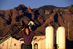
To get the project under way, a small RESOURCE21 plane toting company-owned sensors—similar to those that will be mounted on satellites—sped over ARS research plots in Arizona, California, Iowa, Nebraska, and Texas during the past two growing seasons.
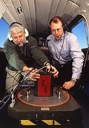
The sensors are digital cameras that view crops or soil in several bands of reflected light—both visible and near-infrared. The cameras record energy as digital numbers representing the amount of light hitting the sensor. ARS provided data to help RESOURCE21 convert the digital numbers to numbers that represent surface properties like reflectance. The company can use these reflectance numbers to create maps for farmers that represent crop and soil conditions. ARS also helped ensure the accuracy of the computer programs that produce the maps.
To represent field conditions, ARS researchers took detailed, systematic measurements of crop growth and development. Called "ground truth," these measurements—captured by more than a dozen different kinds of scientific instruments—determine how well the imagery in digital format correlates with scientists' on-foot field measurements.
Thanks to day after day of clear, sunny skies, research fields of California cotton were the most intensively scrutinized of any in the 1997 field tests. One intent of the in-air and on-ground observation in California was to reveal how quickly the imagery could detect and track cotton plants when they emerged from the soil.
To Sound an Early Warning
That information is critical, says ARS plant physiologist Stephan J. Maas, because the imagery could alert farmers to problems in time for them to take action. Maas and colleague William R. DeTar conducted the tests at ARS' Western Integrated Cropping Systems Research Unit in Shafter.
"Our results," says Maas, "indicate that the imagery is sufficiently accurate to perceive whether the crop is coming up well enough for the grower to let it continue for the rest of the season—or whether it is coming up so poorly the grower needs to replant while there's still time."
"Later in the season," Maas adds, "the imagery can tell you if gaps are appearing in the plant canopy. Because the imagery is keyed to global positioning satellites, you can get the exact coordinates of the trouble spot in the field. You can find out if there is something wrong with your irrigation system, or if insects are attacking the crop, or if there's some other type of problem."
|
|
One of the tougher tests for the computers analyzing the image data was to correctly differentiate dark soil—wetted by a weekly furrow irrigation—from dark-green, healthy leaves of the canopy. For this task, the mathematical models that tell the computer how to interpret the imagery may need to be fine-tuned. Other conditions also affect the ability of the imagery to capture an accurate picture.
"Every time the plane flies, the position of the sun and amount of atmospheric haze and visibility are different," says Susan Moran, an ARS soil scientist at the U.S. Water Conservation Laboratory in Phoenix. "This renders each image slightly different from the previous one, whether or not the soils or crops have changed. Users need a way to compare only those variables that relate to crop health."
So Moran and ARS colleagues Paul J. Pinter, Jr., Edward M. Barnes, and Thomas R. Clarke developed tools that compensate for these extraneous factors. One was a calibration procedure that changes the digital numbers to reflectance values that represent surface conditions more accurately and consistently from one image to the next.
First they calibrated the camera output against an object of known reflectance—a surprisingly tricky task. Moran placed commercially produced canvas tarps at the field sites. The tarps are chemically coated to produce a specific reflectance.
Then Moran's team developed equations that convert the digital numbers to numbers that represent the reflectance of a given image. Normal manufacturing processes and exposure to harsh field conditions cause tarp variability that required Moran to produce a unique equation for each tarp. She also had to teach the users how to place the tarps on the ground and how to clean and store them to ensure accurate readings.
"If a tarp is dirty, its reflectance can change by up to 70 percent," Moran says.
The calibrations compensated for atmospheric conditions, but images still couldn't be compared—because the viewing angle could differ for each flight, skewing the results.
"If you look straight down on a crop, getting what's called a nadir view, you might see that it has 50 percent plant cover," says Moran. "But if you look at the same crop from an oblique angle, it could incorrectly appear that there is almost 100 percent plant cover."
To solve this problem, former ARS physical scientist Jiaguo Qi developed a simple-to-use computer program that converts the reflectance from any viewing angle to the standard nadir view. RESOURCE21 has already started using both the tarps and the model.
To Account for Variation
Researchers at the ARS labs in Ames and Beltsville are also working to compensate for environmental variables.
For example, scientists led by ARS plant physiologist Jerry L. Hatfield at the National Soil Tilth Laboratory in Ames are designing statistical techniques to interpret what's known as temporal variation—the patterns of change seen in aircraft and satellite images over time.
|
|

By viewing the same fields as those scanned by the remote sensors, scientists are able to determine the patterns of the soil color and topography and crop growth. The researchers then analyze the patterns for clues about soil conditions and crop growth over the growing season.
This will allow farmers to pinpoint specific problem sites in a field and apply nutrients and pesticides only where needed.
At the ARS Remote Sensing and Modeling Research Laboratory in Beltsville, research agronomist Craig S. Daughtry and physical scientist Charles L. Walthall are examining digitized images for spatial variability—the differences in height, plant growth, and appearance from one part of the field to another. They're also analyzing spectral properties, or the differences in color within a field and why one area may look greener than another.
But instead of direct experimentation, the scientists are simulating crop and soil reflectances using computer models. To test their models, they obtain data from 3DI, LLC, a geographic technologies company in Easton, Maryland, that uses airborne hyperspectral sensors to scan target areas.
"We can look at more variables and situations in a simulation than we could experimentally," says Daughtry. "Our modeling efforts should tell us what kind of differences the sensors can detect, such as how small a change in leaf area or color could be discerned. This information will help us determine the best light wavelength bands to use to interpret soil and crop conditions over the growing season," he says.
To Detect Yield-Limiting Factors
ARS scientists in Lubbock and Lincoln are testing remote sensing's ability to detect conditions such as water stress and nitrogen deficiency that can reduce crop yields.
In 1998, the second year of trials in Lubbock, a sensor-equipped plane flew over cotton- and cornfields every day to view the effects of the worst April-through-July drought in Texas High Plains history. The project's scientists were able to test remote sensing of nitrogen deficiencies in crops under extremely dry, as well as fully irrigated, conditions.
"The drought and high air temperatures were so bad," says Dan R. Upchurch, "that when we cut back on irrigation by only a third, we grew 80 percent less corn."
"But it was a good year for remote sensing trials because we nearly always had clear skies for aerial viewing of plants under extreme drought conditions." Upchurch leads research at the ARS Cropping Systems Research Laboratory in Lubbock.
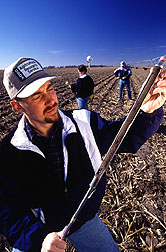
The scientists compared two levels of watering in both corn and cotton to see how reduced watering affected crops during a severe drought. For each water level, they tested five levels of nitrogen fertilizer application.
To verify the aerial readings, Upchurch and agricultural engineer Donald F. Wanjura took ground measurements such as leaf water potential, a measure of how tightly water is held in leaf tissue. They also collected data from a field weather station and a set of infrared thermometers that measure leaf temperature. They took light reflectance measurements of the fields with a boom-mounted camera perched above the canopy.
|
|
The purpose of the experiment was to see whether cameras can detect plant nitrogen deficiency before visible signs appear, under both dry and wet conditions.
Lincoln researchers are working to develop signatures—sort of like fingerprints made of the different light wavelengths—to indicate nitrogen deficiency or water stress.
"For each area, a different stress may predominate," says Lincoln's Schepers. "In Texas, that's water. In Nebraska, nitrogen is of more concern," he says.
A Beneficial Relationship
Richard Baumeister, director of product development for RESOURCE21, values ARS' nationwide network of laboratories, which allows widespread geographic testing—plus ARS expertise in research and validating remote-sensing data on the ground.
"ARS scientists know how to set up nitrogen and drought-stress experiments, while we provide the aerial imagery that is helpful to those experiments," Baumeister says.
"This is a mutually beneficial relationship," he continues. "We want to enhance the management practices of farmers so they make the best possible yields. Sure, we want to make money, but we can't do that if the farmers don't, too."
David G. Mohr, RESOURCE21's director of new business development, adds, "We rely on ARS to make our research reliable and credible. ARS helps us follow the proper research protocol to test our products, making sure our results are valid and applicable to the entire country."—By Kathryn Barry Stelljes, Don Comis, and Marcia Wood, Agricultural Research Service Information Staff. Dawn Lyons-Johnson, formerly with ARS, contributed to this article.
This research is part of Integrated Farming Systems, an ARS National Program described on the World Wide Web at http://www.nps.ars.usda.gov/programs/nrsas.htm.
For more information on this project, contact James S. Schepers, USDA-ARS Soil and Water Conservation Research Unit, 119 Keim Hall, University of Nebraska, Lincoln, NE 68583-0915; phone (402) 472-1513, fax (402) 472-0516.
From Sky to Earth. . . Researchers Capture "Ground Truth" was published in the March 1999 issue of Agricultural Research magazine.