United States Department of Agriculture
AgResearch Magazine


Forum—WEPP: Erosion Prediction for the Next Millennium
|
|

Imagine a day when farmers and ranchers can sit at their desks, click an icon on their computers, and estimate wind and water erosion that could be expected from each of the ways that they might manage their land.
Imagine, too, that they could just as easily estimate the effect of their land-use decision on the movement of topsoil, water, and chemicals from their farms and ranches into the air or as surface runoff, tile drainage, or groundwater leaching.
Producer decisions based on computer-generated if-then estimates could both optimize real income and preserve, indefinitely, the natural resources that production capability and profitability depend on.
Such decisionmaking is not as farfetched as it may seem. Agricultural producers could make many of these predictions using ARS natural resource models that have already been developed. And one important part of such a scenario would be use of WEPP—short for Water Erosion Prediction Project model.
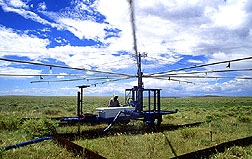
The WEPP project was conceived to replace the Universal Soil Loss Equation, a technology initiated for use in conservation planning during Franklin D. Roosevelt's second term. The equation has been used on nearly every piece of agricultural land in the United States and in much of the rest of the world, as well. To replace such a venerable technology has been a formidable undertaking.
WEPP has required more than a decade of extensive research—from experiments on soil erodibility to statistical analyses for equations to predict peak rate of runoff. In WEPP, we have married the science of soil erosion to the immense power of the computer.
But to paraphrase Daniel Hillel, one of the world's foremost soil physicists, what has been done in WEPP is no different than what scientists have been doing for centuries. Essentially, WEPP developers have tried to understand how nature operates in order to predict the future course of natural events. These natural events are erosion events. And we predict them using a computer model.
WEPP will be an important tool to help managers select the best way to produce on, and yet protect, a specific farm or ranch—based on its soil, topography, and climate. It will help farmers keep their ponds clear and their ditches free of sediment. It will help them meet any federal and state requirements regarding erosion or sediment yield.
|
|
And WEPP will put a scientific base under the environmental standards and expectations set by regulatory agencies. Not only will this help ensure development of realistic standards for producers to meet, it will make possible more accurate and irrefutable environmental determinations.
Naturally, the system of climate, soil, topography, plants, and management practices that WEPP models is very complex. And not only must this system be modeled accurately, but so must its individual components. This complexity is why some foresee WEPP being used primarily by natural resource managers and production consultants—rather than farmers and ranchers—in the immediate future.
However, continuing software developments should one day make it easier for farmers and ranchers to apply the model themselves. Because ultimately, though WEPP is a complex model, it is intended as an easy-to-use tool for a wide variety of 21st century users.
Ideally, I'd like even schoolkids to one day be able to use WEPP in projects related to urban construction and offsite sediment delivery—or in 4-H projects related to agriculture and the environment. After all, my 10-year-old grandson can already balance the managerial choices in SimCity, the computer game, quite comfortably.
A continuing challenge will be to make WEPP the user-friendly tool that it needs to be for maximum utility. This requires cutting-edge systems and human-factor engineering, along with computer science. We're not there yet—but we're getting there.
As it is, WEPP fits perfectly into ARS' mission: both improving management and conservation of precious natural resources and supporting programs of other federal agencies. WEPP integrates scientific knowledge into a tool that should, in combination with others, help optimize the twin goals of resource management and technology transfer.
Thanks to this and other ARS natural resource models, our agency is providing the technology to sustainably manage the world's land and water resources. Protecting the land becomes increasingly important as we face the prospect of having to feed a growing population on shrinking acreage.
And implementing the new erosion prediction technology in the WEPP model comes at a time when other problems are being approached similarly. For example, a companion modeling project is related to wind erosion. Water quality models have already been developed and are being applied.
Emphasis now is on bringing these models together so that they can use common databases and run under a common user-friendly interface. The prospects are exciting.
John M. Laflen
WEPP Project Leader