Global Warming in Western Mountains
|
|
More than 50 years of records in the western mountains of the United States show that while it is now significantly warmer, total annual precipitation has not changed. But a system that was once dominated by winter snowfall now experiences a mix of rain and snow, with more streamflow in winter and less in spring. As a result, there is less water for ecosystems and agriculture during the spring and summer growing season. These changes make forecasting and managing western water resources more difficult and present a serious challenge to agriculture in the region.
Over the past five decades, mean temperatures rose 2˚–3˚C, according to Agricultural Research Service (ARS) data from the Reynolds Creek Experimental Watershed (RCEW). Warming has occurred across a range of elevations, with the greatest increases in minimum temperatures. The impact of this has been less snow and more rain, again at all elevations, but with the most profound changes at lower elevations, which saw a shift from 44 percent snow to 20 percent.
Western Mountains Sensitive to Warming
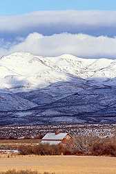
Danny Marks, a hydrologist who specializes in snow and cold-season hydrology of mountain regions, directed this analysis, working with soil scientist Mark Seyfried and other colleagues. Marks and Seyfried are at the ARS Northwest Watershed Research Center in Boise, Idaho, which manages the RCEW in Idaho’s Owyhee Mountains, near Boise. The Owyhee Mountains are part of the Great Basin of the intermountain western United States. Reynolds Creek is the U.S. Department of Agriculture’s premier mountain observatory.
Marks says: “Two characteristics of the RCEW, and western mountains in general, accentuate the sensitivity of the region to this shift from a snow-dominated to a rain-dominated regime, especially at low to mid elevations. First, more than 95 percent of the watershed is at mid to low elevations.”
|
|
So, changes which affect those elevations are much more important from a water-resources perspective. While the ARS analysis shows that there have been changes in the high-elevation snow cover, these are relatively minor compared to the effect that warming has had on the mid and low elevations. Marks says that “this is an important consideration, because most of our snow-measurement sites across the western United States, such as the USDA Natural Resources Conservation Service’s SNOTEL (Snow Telemetry) system, are high-elevation measurement sites that can’t detect the strong trends shown in our analysis of the RCEW at the mid to low elevations.”
Marks says the second characteristic of the region is that while it was snow dominated, most of the mid- and low-elevation land area in the watershed, and in much of the western mountains, has temperatures and storm conditions that “are not far from the rain-snow transition.”
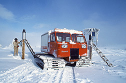
Hydrologically, the region is very sensitive to relatively small increases in temperature. This is illustrated in the long-term snow measurements at Reynolds Creek, where high-elevation sites show a modest decrease in peak snow water content, and almost no change in the date it peaks. But the mid- and low-elevation snow-measurement sites show more than a 60-percent reduction in peak snow water content. And the peak now occurs a month or more earlier.
Further, the snow season is shorter, starting later and ending sooner at all elevations. At high elevations this difference is less than a month, at mid elevations a month or two, and at lower elevations two to three months. At lower elevations, the snow cover is now ephemeral, with only a few months of continuous snow cover each year. During 8 of the first 20 years of records at the watershed, there was measureable snow on May 1 at the lowest snow-measurement site.
“There has been no snow at that site on May 1 since 1984,” Marks says.
|
|
Nature’s Reservoir in Decline
Marks also says that the effect of warming on the snow cover has been transferred directly to streamflow. “While annual total streamflow volume has not changed at the RCEW over the last 50 years, more streamflow occurs during winter and early spring and less during summer.
“At a small high-elevation area which collects water, representing just over 1 percent of annual flow from the watershed, March and April streamflow increased substantially,” he says. “The streamflow was unchanged in May, and in June it decreased by more than half. From a larger mid-elevation basin, representing about 80 percent of annual flow from the watershed, March and April streamflow increased substantially, May increased slightly, while June decreased 35 percent.
“This shows that not only is streamflow occurring earlier, but more of the annual flow is concentrated in the March–June period, leaving even less for the dry summer growing season,” Marks says.
West’s Water Forecasting in Doubt?
“In the mountains of the West,” Marks says, “the seasonal snow cover is Nature’s reservoir, storing water from winter snowstorms for release to the soil and streams during spring and early summer. Water resource management in the West is based on a reliable spring rise in streams from snowmelt. If, as we have observed in the Reynolds Creek Experimental Watershed, this system is changing, then our ability to effectively forecast water supply for the region is uncertain. Our analysis shows that climate warming is causing the rain-snow transition to move upslope. As we go to higher elevations, changes are subtle and may not show up as significant for a decade or more. But if these trends continue, as predicted, for the next 50 to 100 years, Reynolds Creek and similar areas in the West will be very different. We need to anticipate these changes and plan adjustments in our approach to managing water resources in the West.”—By Don Comis, Agricultural Research Service Information Staff.

This research supports the USDA priority of responding to climate change and is part of Water Availability and Watershed Management, an ARS national program (#211) described at www.nps.ars.usda.gov.
Danny Marks and Mark S. Seyfried are with the USDA-ARS Northwest Watershed Research Center, 800 Park Blvd., Boise, ID 83712; (208) 422-0721 [Marks], (208) 422-0715 [Seyfried].
"Global Warming in Western Mountains" was published in the January 2011 issue of Agricultural Research magazine.


